
The Big Data Revolution: Detecting Pipeline Leaks, Encroachments and more Using Satellites
Benefiting from the vast capacity and speed provided by cloud computing, remote sensing technology is quickly expanding from infrequent projects to becoming an integral part of on-going operations.
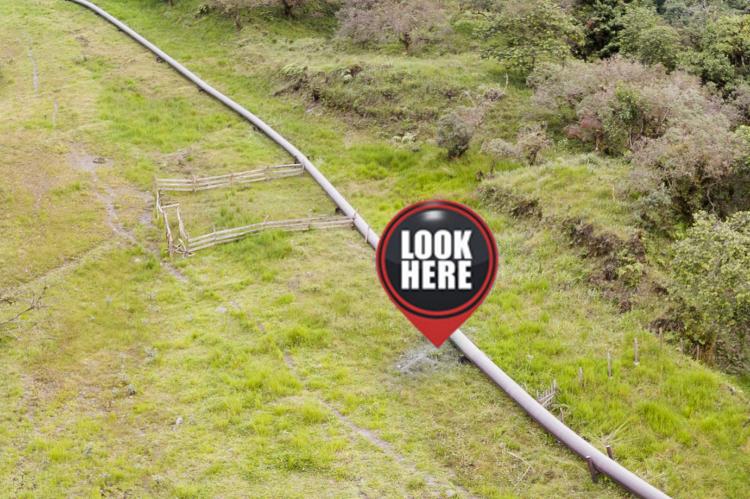
We have seen many innovative applications in this arena, particularly at oil & gas, pipeline, and power companies, where their large spatial footprint is challenging for conventional approaches. In this article, we make the case for applying Remote Sensing Technology (RST) and Geospatial Analytics (GA) for on-going operations and give two examples to demonstrate RST in operation could significantly reduce risks and liabilities for pipeline operators.
This technology can also be used to monitor pipelines and the rights-of-way for hydrocarbon leaks, change detection, land slips and slides, vegetation growth, water temperature, illegal (hot) tapping, and many more biological and chemical constituents of both land and water. We are confident that with the rapid commoditization of remote sensing data collection, RST/GA will be widely adopted in pipeline, oil & gas, and power companies.